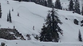
In December, snowpack in the Sierra was below normal levels, warning some water experts of a drought. Since then, a few storms have passed. Reno Public Radio's Bree Zender checks in again with Jeff Anderson, a hydrologist from the Natural Resources Conservation Service about where the snowpack levels are today, and how that could affect water flow.
Zender: When we last talked, there wasn't a lot of snow in the Sierra. What's the status right now?
Anderson: You know, I think the status since January 1 has just been sort of a downhill slide, which sounds like fun, but really for our snowpack, it's far from that. Our snowpack right now in the Sierra Basin up to Lake Tahoe, Truckee, Carson and Walker Basins, if you kind of average all four of those: 37 percent of median. And I guess what I would add is the snow is not evenly spread across the mountains; the same pattern that we saw in January is still with us.
Below 8,000 feet, we are only seeing 20 percent of normal, and above 8,000 feet, the number's actually even slipped below half of normal, just around 47 percent of normal. So the pattern is the same, but the numbers keep getting lower. That's not really due to a lot of the snow melting yet. We've had some storms, and they've added to the snowpack, so our snow water amounts have increased, but the problem is they're not increasing and keeping up with the normal amounts, which increase a little bit every day.
We should be getting storms every week, and we just haven't. If you look at the last 75 days, this is the driest December 1 through Feb 15 period on record.
Zender: Tell me how you determine what 'normal' is.
Anderson: Yeah, for the snowpack, we use the median, so that's the middle number. So most of our records from our SNOTEL sites that collect hourly data, those records go back to about 1980. If you use an average, and you average in years like last year that were just so huge, it can really bump the average up to what's probably... it's not really representation of a normal year. The average is actually bigger than a normal year might be, so we use a median for snowpack for that reason.
Zender: So, since last year was pretty huge in terms of precipitation numbers, how much do we have in storage at this point?
Anderson: If you compare this winter to 2015, there's many similarities in terms of how little snow there is, but the difference is 2015 is the last year of a four-year drought, and this is the first year moving into more of a drought scenario, with a low snowpack. We do have reservoir storage. It's really good. The water in our lakes across Northern Nevada is above average for this time of year, and many of these reservoirs are at 80 to 90 percent of their capacity.
Zender: Are there other areas of Nevada that are experiencing this?
Anderson: [In] Southern Nevada, we actually don't have a lot of measurements there. We've installed SNOTEL sites there recently, in the last 10 years or so. We don't have enough years to have a meaningful normal amount. The amounts down there are definitely low as well.
In the Humbolt Basin and in Eastern Nevada, those are two areas of the state that have very low percents of normal, both similar to the Sierra's 35 percent of normal or so. But it's the lowest snowpack on record for those basins for this time of year, which is concerning.
And in Eastern Nevada, they've had very little precipitation so not only haven't they got the snow, but they haven't gotten the storms, so they're also at a record low precipitation amount for the year as well.


